
Near record Skagit River flood stage in Mount Vernon Monday closes downtown bridge
November 17, 2021
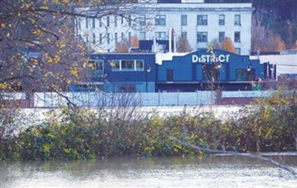
DURING (second photo) AND AFTER (first) THE FLOOD – Tuesday morning the Skagit River was receding from its 36.7’ crest in downtown Mount Vernon. This scene is looking from the westside, across a playground area in Edgewater Park, literally at the edge of the water. The insert is from the east bank Saturday before the floodwalls were set up to protect the downtown from Monday’s rising waters. – Photo by Ken Stern
City of Mount Vernon staff and businesses prepared for near historic flooding of the Skagit River in the downtown area Monday, with the City of Mount Vernon declaring a civil emergency as of 6 a.m. The river measured 35.3’ at 9:45 p.m. at the USGS (United States Geological Service) gauge at the Riverside bridge. It more than doubled in height, rising 18.8’ from its 5:30 p.m. Nov. 10 measurement of 16.5’.
Phase 2 flood stage is 32.0-35.6’.
The City of Mount Vernon termed it “serious and historic flood levels.” Residents in the floodplain were advised to “take action over the next 24-48 hours to protect their homes, families and property from floodwaters.”
City staff deployed the flood wall along the riverwalk south of the Division Street bridge Monday morning.
Saturday the river crested at 28.3’ at 8 a.m. then fell for the next 21 hours to 26.2’ by 7 a.m. Sunday morning, below Phase 1 flood stage. The river then began a 38 hour rise.

Around 6:45 p.m. Monday City staff recommended evacuation for residents of west Mount Vernon, writing “evacuation is the best option for people to protect themselves in a severe flood event. A flood is threatening areas west of the Division Street.” Earlier, at 4:53 p.m., City staff announced the closing the Division Street bridge except to emergency traffic at 9 p.m. and that the Red Cross had opened a shelter at Bethany Covenant Church.
The river crested in Mount Vernon at 36.7’ at 5:17 a.m. Tuesday, based on the USGS website. The gage was damaged and not reporting data for four hours Monday afternoon and again overnight until after 5 a.m.

At 11:45 a.m. the river had receded to 36.5’.
The 35.3’ river level is the fourth highest flood since the 1991 record of 37.4’, matched in 1996. In 2004 the river crested at 36.2’ in Mount Vernon.
By 8 a.m. Monday Skagit County Dike District 1 employed crews and equipment to build a berm on the westside of Edgewater Park, along 1,000’ of South Ball Street from the dike north to Division Street. Arne Svendsen estimated that his firm was bringing in 500 yards of sand, which he estimated to be 750 tons. “Call it making a burrito. Flip it over and seal it up,” Svendsen said, referring to the excavator operated by Mike Cheek the owner of Catapult Heavy Construction, placing sand on top of heavy plastic sheeting. They worked through the steady rain and wind that went on past 1 p.m.

Some West Division Street businesses placed sandbags two feet high in front of their doors. Large ground level air vents had plywood sheets secured in front of them on the building across from the Skagit Valley Food Co-op.
The Co-op announced it was closing at 4 p.m. for the safety of customers and staff.
Monday afternoon La Conner Town Administrator Scott Thomas sent an email to the mayor, council members and staff, updating them with information from the Skagit County Emergency Operation Center. Thomas wrote “Our greatest concern is the stability of the levees, but the dike districts monitor their infrastructure very closely during events and the likelihood of an unexpected catastrophic failure is small.” He advised “We are closely monitoring the situation, but do not expect to have any issues” and noted “Temps are expected to drop significantly, which will lower the snow elevation and minimize rainfall into the Skagit basin.”
In town, Public Works Director Brian Lease reported, Thomas wrote, “that the new storm pumps at the end of Caledonia (Street) are working well, that the high tide has not caused problems and that we are well situated to ride this one out.”
The La Conner school campus was closed Tuesday, with classes held remotely with a two-hour delay, Executive Assistant Cherri Kahns wrote in an email Monday afternoon, based on weather conditions and recommendations from Skagit County Emergency Management. After-school activities were canceled Monday and Tuesday. The middle and high schools choir and band concert was rescheduled for 7 p.m. Thursday, Nov. 18 in the high school gym.
Tuesday Fir Island was closed to thru traffic, Skagit County Sheriff’s Office Undersheriff Chad Clark reported in an email. “Once the river level recedes to 28’ it will re-open. The water continues to recede and we are hopeful the island will be re-opened for thru traffic later today,” he wrote.
Tuesday the Skagit County Emergency Operations Center recommended that Samish Island residents consider evacuating Samish Island or plan to shelter in place until the water level recedes. The concern: a high likelihood that when the Samish River crest reaches the river delta flooding will occur on Samish Island Road, cutting residents from the mainland.
The Red Cross shelter at Bethany Covenant Church was recommended for those needing emergency shelter,
Steady rain started 6 p.m. Nov. 13, falling almost continuously till 2 p.m. Monday afternoon, totaling 1.5” at the WSU Extension Center on Memorial Highway.
Reader Comments(0)